| Watershed is defined as a geohydrological unit draining to a common point by a system of drains. All lands on earth are part of one watershed or other. Watershed is thus the land and water area, which contributes runoff to a common point. A watershed is an area of land and water bounded by a drainage divide within which the surface runoff collects and flows out of the watershed through a single outlet into a lager river ( or ) lake.TYPES OF WATERSHEDWatersheds is classified depending upon the size, drainage, shape and land use pattern.Macro watershed (> 50,000 Hect)Sub-watershed (10,000 to 50,000 Hect)Milli-watershed (1000 to10000 Hect)Micro watershed (100 to 1000 Hect)Mini watershed (1-100 Hect)Objectives of watershed managementThe different objectives of watershed management programmes are:· To control damaging runoff and degradation and thereby conservation of soil and water.· To manage and utilize the runoff water for useful purpose.· To protect, conserve and improve the land of watershed for more efficient and sustained production.· To protect and enhance the water resource originating in the watershed.· To check soil erosion and to reduce the effect of sediment yield on the watershed.· To rehabilitate the deteriorating lands.· To moderate the floods peaks at down stream areas.· To increase infiltration of rainwater.· To improve and increase the production of timbers, fodder and wild life resource.· To enhance the ground water recharge, wherever applicable.Factors affecting watershed managementa) Watershed charactersi) Size and shape ii) Topography iii) Soils iv) Reliefb) Climatic characteristici. Precipitation ii. Amount and intensity of rainfallc) Watershed operationd) Land use patterni. Vegetative cover ii. Densitye) Social status of inhabilityf) Water resource and their capabilities.Watershed management practices 1. Interms of purpose 1. To increase infiltration 2. To increase water holding capacity 3. To prevent soil erosion 2. Method and accomplishmentIn brief various control measures are: 1. Vegetative measures ( Agronomical measures) 1. Strip cropping 2. Pasture cropping 3. Grass land farming 4. Wood lands 2. Engineering measures ( Structural practices 0 1. Contour bunding 2. Terracing 3. Construction of earthern embankment 4. Construction of check dams 5. Construction of farm ponds 6. Construction of diversion 7. Gully controlling structure 1. Rock dam 2. Establishment of permanent grass and vegetation 8. Providing vegetative and stone barriers 9. Construction of silt tanks dentension Influence of soil conservation measures and vegetation cover on erosion, Runoff and Nutrient loss. Rainwater harvesting is the main component of watershed management. Some of the watershed management structures are as follows. BROAD BEDS AND FURROWSa. FUNCTION To control erosion and to conserve soil moisture in the soil during rainy days.b. GENERAL INFORMATIONThe broad bed and furrow system is laid within the field boundaries. The land levels taken and it is laid using either animal drawn or tractor drawn ridgers. 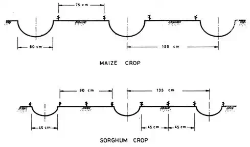 BROAD BEDS AND FURROWS 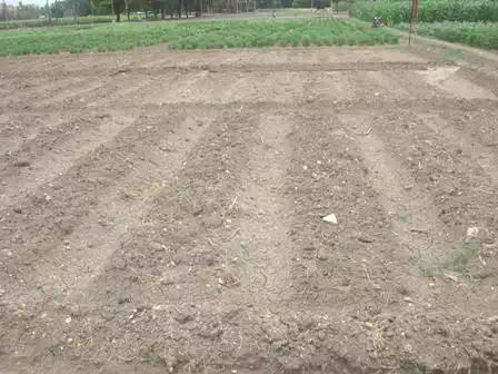 c. COST c. COST Approximate cost for laying beds & furrows is Rs.1800 / ha.d. SALIENT FEATURESConserves soil moisture in drylandControls soil erosion.Acts as a drainage channel during heavy rainy days.CONTOUR BUND a. FUNCTION To intercept the run off flowing down the slope by an embankment. 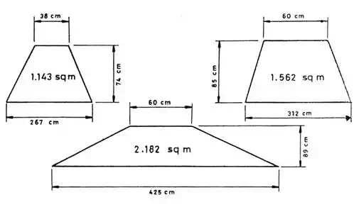 CONTOUR BUND 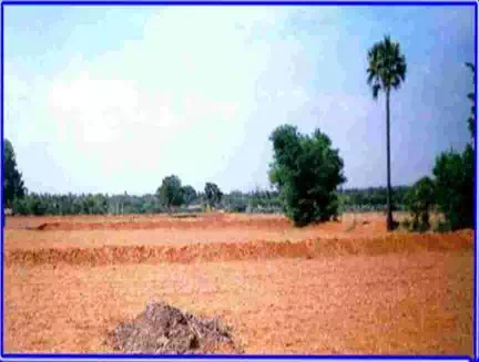 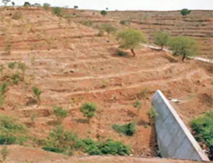 Contour bundingb. GENERAL INFORMATIONIt helps to control run off velocity. The embankment may be closed or open, surplus arrangements are provided wherever necessary.c. COSTApproximate cost of laying contour bund is Rs.1400 / ha.d. SALIENT FEATURESi. It can be adopted on all soils ii. It can be laid upto 6% slopes. iii. It helps to retain moisture in the field.BENCH TERRACINGa. FUNCTIONIt helps to bring sloping land into different level strips to enable cultivation. 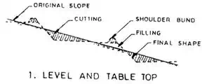 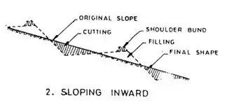 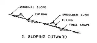 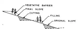   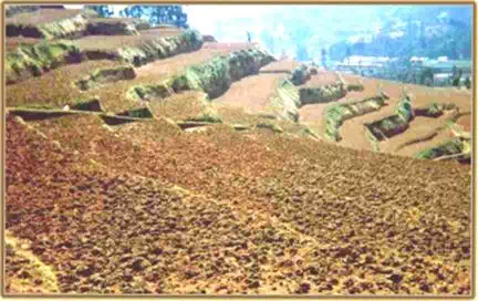 TYPES OF BENCH TERRACESb. GENERAL INFORMATIONIt consists of construction of step like fields along contours by half cutting and half filling. Original slope is converted into level fields. The vertical & horizontal intervals are decided based on level slope.c. COST Approximate cost for laying the terrace is Rs.5000 / ha.d. SALIENT FEATURESSuitable for hilly regions.The benches may be inward sloping to drain off excess water.The outward sloping benches will help to reduce the existing steep slope to mild one.It is adopted in soils with slopes greater than 6% MICROCATCHMENTS FOR SLOPING LANDS a. FUNCTIONIt is useful for insitu moisture conservation and erosion control for tree crops. 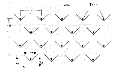 MICROCATCHMENTS  b. GENERAL INFORMATIONTechniqueStorage capacity b. GENERAL INFORMATIONTechniqueStorage capacityper unit (m3)Annual run-off contribution to soil moisture Additional water stored per ha (m3)Estimated surface Run-off control (%)Triangular catchments (V-Bunds)13520080Crescent bunds10.2408073c. COSTTechniqueCost/ha (Rs.)Triangular catchments (V-Bunds)6000-7000Crescent bunds2500-3000d. SALIENT FEATURESSlope ranges from 2 –8%Soil type – Light to moderate textureInsitu moisture conservation with staggered plantingSuitable for dry land Horticulture & AgroforestryBund height – 30 to 45 cm. Check dam 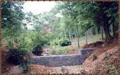 Salient featuresA low weir normally constructed across the gulliesConstructed on small streams and long gullies formed by erosive activity of flood waterIt cuts the velocity and reduces erosive activityThe stored water improves soil moisture of the adjoining area and allows percolation to recharge the aquifersSpacing between the check dams water spread of one should be beyond the water spread of the otherHeight depends on the bank height, varies from a metre to 3 metre and length varies from less than 3m to 10m Cost varies from Rs. 40000/- to Rs. 100000/- per unit Percolation pond: Salient featuresA low weir normally constructed across the gulliesConstructed on small streams and long gullies formed by erosive activity of flood waterIt cuts the velocity and reduces erosive activityThe stored water improves soil moisture of the adjoining area and allows percolation to recharge the aquifersSpacing between the check dams water spread of one should be beyond the water spread of the otherHeight depends on the bank height, varies from a metre to 3 metre and length varies from less than 3m to 10m Cost varies from Rs. 40000/- to Rs. 100000/- per unit Percolation pond: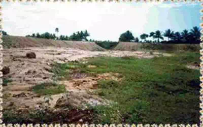 Function FunctionTo augment the ground water rechargeSalient featuresShallow depression created at lower portions in a natural or diverted stream coursePreferable under gentle sloping stream where narrow valley existsLocated in soils of permeable natureAdaptable where 20-30 ground water wells for irrigation exist with in the zone of influence about 800 – 900mMinimum capacity may be around 5000 m3 for the sack of economyAlso act as silt detention reservoirCost varies from Rs. 60000 to 150000 per unitStone Barriers 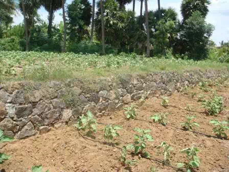 |
My WordPress Blog


Comments are closed.